The inspection of underground or confined infrastructures using drones and robots enables a rapid and precise assessment of the condition of the facilities, thereby reducing downtime and maintenance costs. The collected data, such as high-resolution images and point clouds, facilitate an in-depth analysis of structural integrity and potential issues.
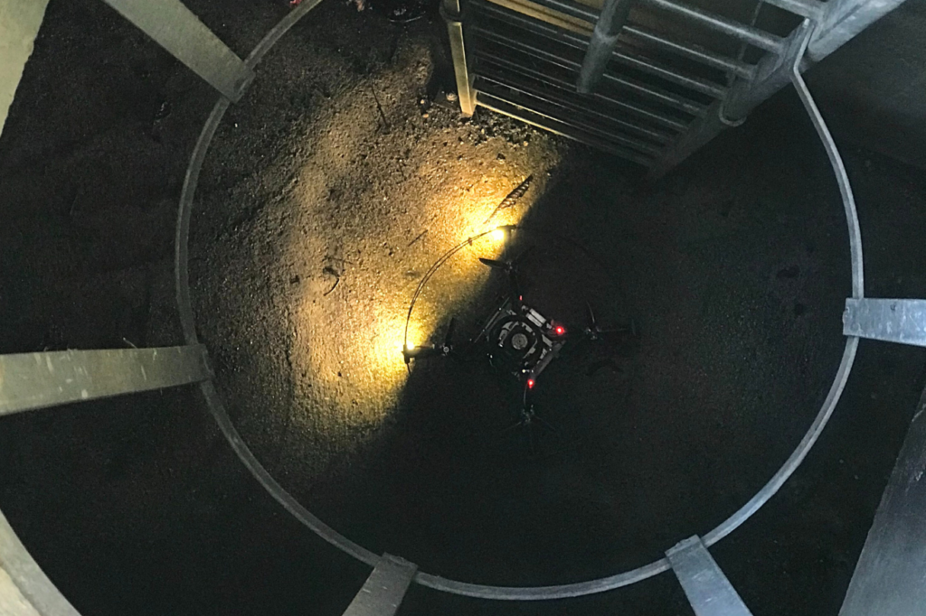
In this mission, Lynxdrone’s indoor drone enabled the inspection of galleries, geolocation without GNSS, georeferencing of collected images, and real-time modeling of the environment. The post-processing of data was supported by Lynxdrone’s artificial intelligence algorithms.
Context
Underground galleries are typically accessible structures designed for inspection and maintenance. Human intervention within these structures presents several risks, including asphyxiation, drowning, exposure to toxic or biological gases. Lynxdrone’s drones, equipped with high-resolution cameras, gas sensors, GNSS-independent geolocation systems, and autonomous navigation technologies, revolutionize the inspection of these environments while ensuring operator safety.
On-Site Intervention
Types of Surveys
Indoor 3D Scanning Colored Point Clouds Images and Videos
Equipment
Indoor Drone (Lynxdrone)
Detailed and High-Quality Deliverables
We provide comprehensive support, ensuring each step aligns with your expectations. Every project is unique, which is why our approach is tailored to meet your specific needs. At the end of the mission, deliverables are presented and discussed to ensure your complete satisfaction.
Intervention is Risky… Without Lynxdrone’s Solutions
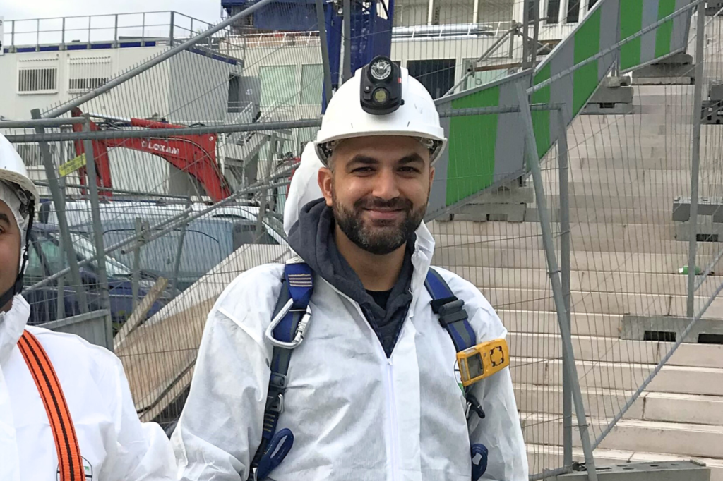
Human intervention in confined spaces is generally dangerous and, in some cases, can be fatal for operators. Personal Protective Equipment (PPE) is mandatory to ensure the safety of personnel. Lynxdrone’s intervention team members hold the CATEC certification (Capacity to Work in Confined Environments) to guarantee the successful execution of the mission.
Facing a Complex Environment, a Lynxdrone Drone
The inspection and modeling of underground galleries using a drone (without entering the structure) present several challenges, notably piloting from the surface without direct visual contact with the drone. Lynxdrone has invested over five years of research and development with industry experts to create innovative technological solutions, making these inspections simple, efficient, and safe for operators.
Environmental Perception and GNSS-Independent Geolocation
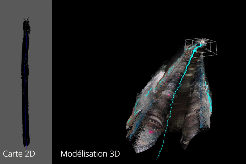
The embedded algorithms on the drone enable real-time 3D modeling of the environment, enhancing the safety and efficiency of the inspection mission. The resulting point cloud facilitates the creation of digital models and site plans. These algorithms also allow for the geolocation of the drone and captured data, improving anomaly management from identification to repair.
A cross-section of an ortho-point cloud shows the change in section and access to the structure via stairs.
The quality of the captured data (images, videos, point clouds, etc.) enables the generation of high-quality deliverables. The point cloud and resulting digital model are now essential tools for Computer-Assisted Maintenance Management (CMMS) of infrastructures.
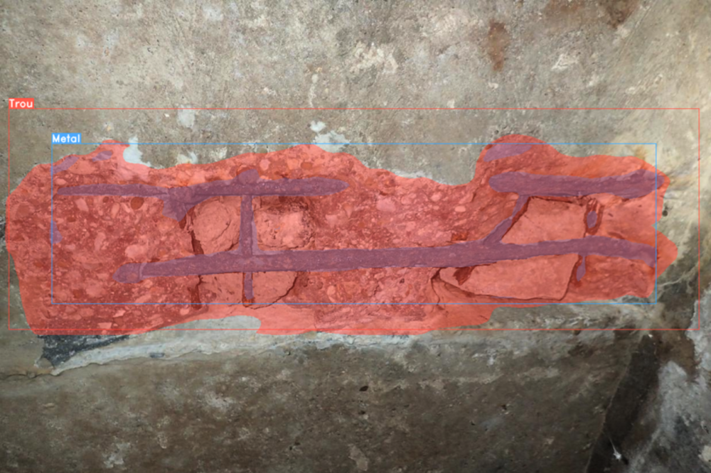
Artificial Intelligence for Enhanced Reports
The geolocation of images and post-processing using artificial intelligence improve the quality of reports, reduce drafting time, and lower associated costs.
Contact Us
7 Avenue de Guitayne, 33610, Canéjan, France
contact@lynxdrone.fr
+33 6 64 29 91 64
Cookie Consent
Nous utilisons des cookies pour améliorer votre expérience sur notre site. En utilisant notre site, vous acceptez les cookies.
This website uses cookies
Websites store cookies to enhance functionality and personalise your experience. You can manage your preferences, but blocking some cookies may impact site performance and services.
Essential cookies enable basic functions and are necessary for the proper function of the website.
Name
Description
Duration
Cookie Preferences
This cookie is used to store the user's cookie consent preferences.