Monitor Your Construction Sites As If You Were There
Drone-based construction site monitoring provides a precise aerial view at various stages of a project, enabling tracking of progress, improving safety, and reducing costs.
Drones deliver detailed data for in-depth analyses and facilitate communication among the various industry experts involved in the project.
Lynxdrone has implemented intervention protocols and digital tools to enable its clients to effectively monitor their construction sites.
Context
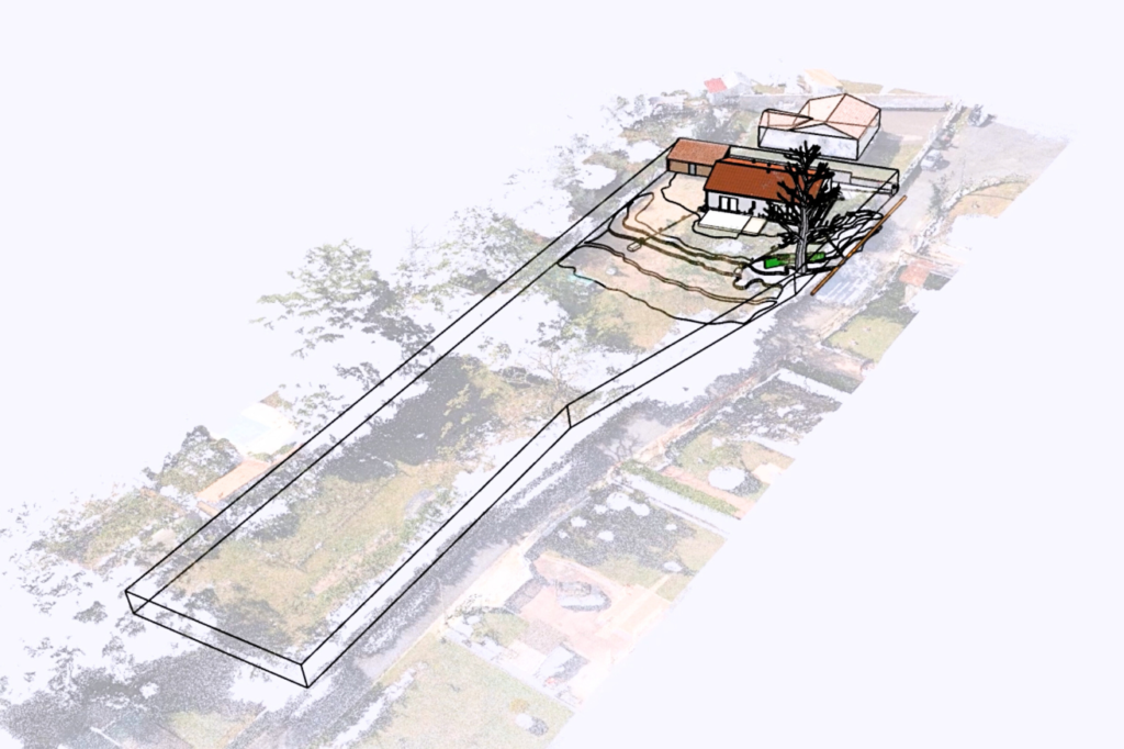
To monitor the progress of a damaged house, a site map detailing elevation levels and an overall view of the terrain allowed the expert to perform their analyses. Additionally, a BIM model of the site, incorporating cracks in the house and underground drainage networks, enabled the expert to illustrate completed work and precisely plan potential future work.
On-Site Intervention
Types of Surveys
Site Mapping Building Inspection Building Modeling via Photogrammetry Digital Model Construction
Equipment
M 300 RTK Drone – 45-Megapixel Camera
Detailed and High-Quality Deliverables
We provide comprehensive support, ensuring each step aligns with your expectations. Every project is unique, which is why our approach is tailored to meet your specific needs. At the end of the mission, deliverables are presented and discussed to ensure your complete satisfaction.
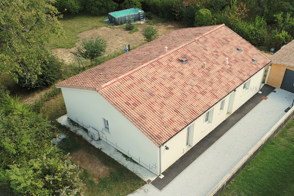
Building Inspection by Drone
The drone simply provides a comprehensive overview of the entire site, facilities, and buildings. It enables rapid access to hard-to-reach areas and delivers precise, real-time data.
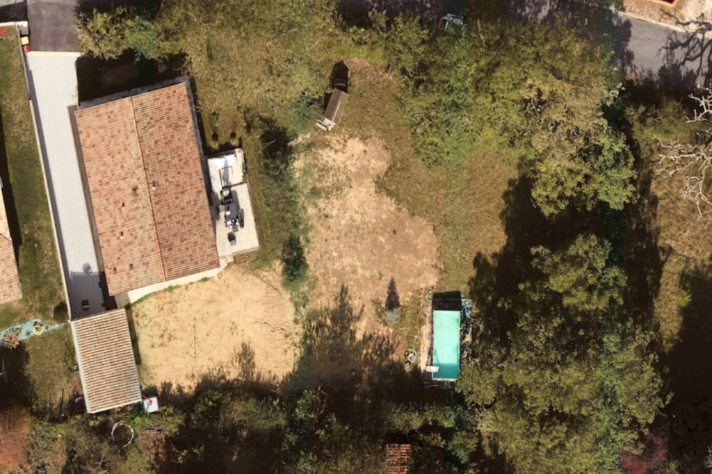
Site Mapping
Site mapping by drone involves flying over a defined area encompassing the residence and capturing high-resolution aerial images. These images are then processed to create a detailed and accurate map of the surrounding terrain. This type of deliverable is essential for obtaining an overall view of the site.
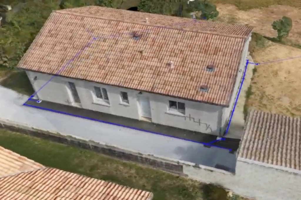
Building Photogrammetry
The 3D model obtained through photogrammetry is created from multiple aerial images captured from different angles of the building. These images are processed to reconstruct an accurate three-dimensional representation of the building in its current state.
This type of deliverable is useful for in-depth analyses, restoration simulations, visual presentations, or communication purposes.
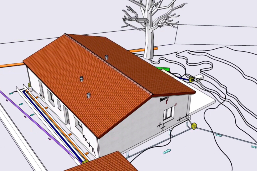
Digital Model
The digital model is an essential tool for improving intervention safety, infrastructure management, and maintenance planning.
In this study, repair work and existing networks were documented in the digital model for improved site management.
Integration of Multiple Data Sources into the Digital Model
Integrating the digital model with site mapping facilitates comparing actual construction progress with the initial plan, identifying discrepancies and potential issues.
This approach enhances the accuracy of monitoring, accelerates decision-making, and optimizes coordination among project teams, thereby promoting efficient site management.
Contact Us
7 Avenue de Guitayne, 33610, Canéjan, France
contact@lynxdrone.fr
+33 6 64 29 91 64
Cookie Consent
Nous utilisons des cookies pour améliorer votre expérience sur notre site. En utilisant notre site, vous acceptez les cookies.
This website uses cookies
Websites store cookies to enhance functionality and personalise your experience. You can manage your preferences, but blocking some cookies may impact site performance and services.
Essential cookies enable basic functions and are necessary for the proper function of the website.
Name
Description
Duration
Cookie Preferences
This cookie is used to store the user's cookie consent preferences.