Inspection and Analysis of Thermal Loss in a Residence
Using Drones to Combat Energy Resource Loss
Buildings, often exposed to various external factors, require regular and thorough inspections to ensure their safety and durability. Through advanced analysis and detection techniques, it is possible to precisely examine the facades of structures.
Drone-based thermal analysis is an inspection technique that identifies areas of thermal loss in buildings.
Using a drone equipped with an infrared camera, roofing and facade surfaces are meticulously explored to detect any heat loss.
Lynxdrone equips its drone with multiple sensors, enabling both precise building inspection (up to 40 pixels/mm) and thermal loss analysis.
Context
The objective of this mission is to inspect the facades and roofing of buildings to determine their current condition and any necessary repair work.
On-Site Intervention
Types of Surveys
Exterior 3D Scanning Site Mapping Building Inspection Thermal Inspection
Equipment
Fixed Scanner M 300 RTK Drone – Multi-Sensor Camera
Detailed and High-Quality Deliverables
We provide comprehensive support, ensuring each step aligns with your expectations. Every project is unique, which is why our approach is tailored to meet your specific needs. At the end of the mission, deliverables are presented and discussed to ensure your complete satisfaction.
Exterior 3D Scanning
The 3D scanning of the site involves comprehensively capturing the geometric and spatial data of the external environment, including structures, topographical elements, and architectural details.
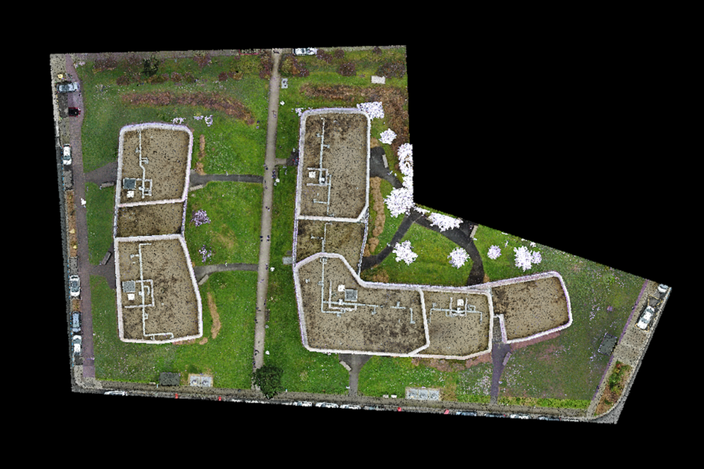
Site Mapping
Site mapping by drone involves flying over a defined area encompassing the residence and capturing high-resolution aerial images. These images are then processed to create a detailed and accurate map of the surrounding terrain. This type of deliverable is essential for obtaining an overall view of the site.
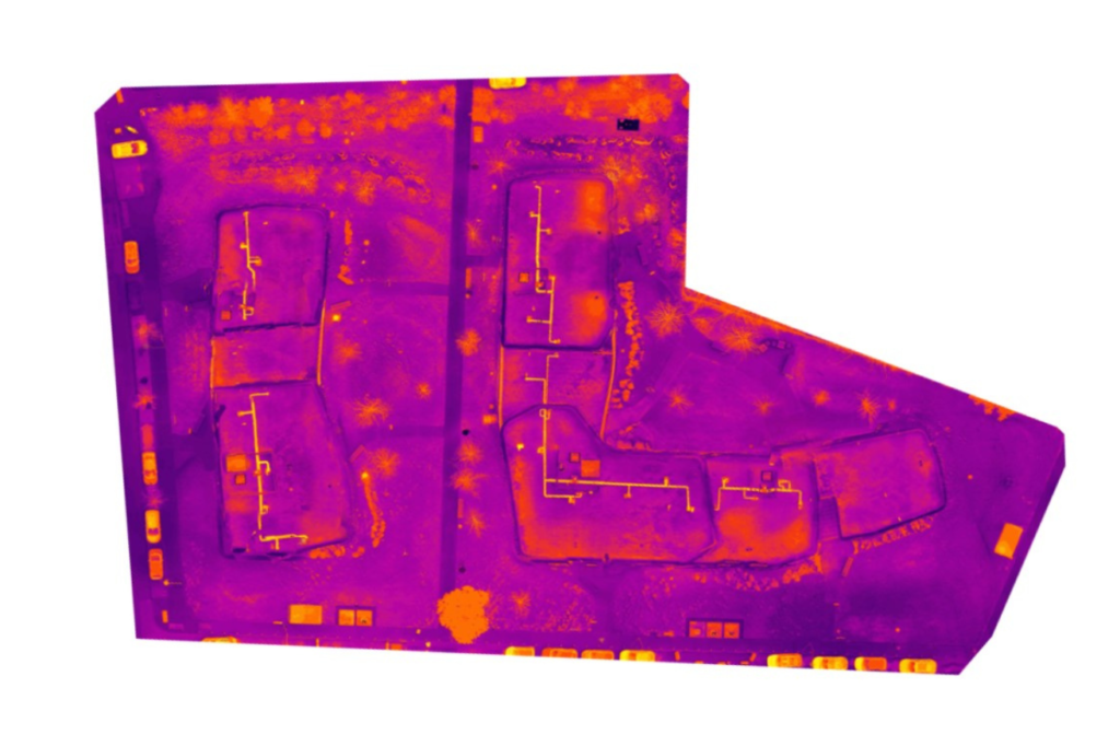
Thermal Site Mapping
Thermal site mapping provides a comprehensive view of the roofing and detects potential thermal losses.
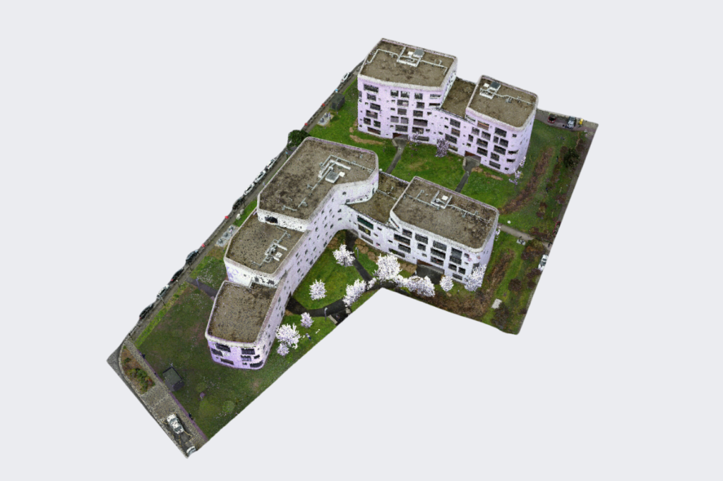
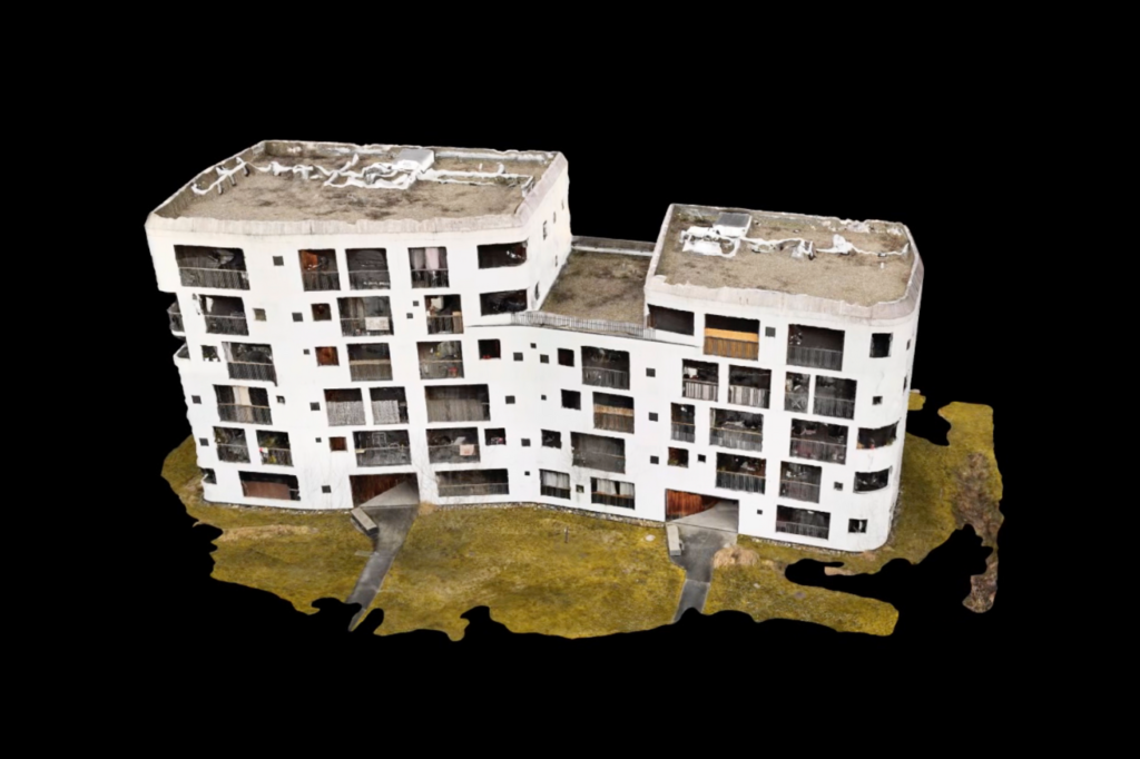
3D Model via Photogrammetry
The 3D model obtained through photogrammetry is created from multiple aerial images captured from different angles of the building. These images are processed to reconstruct an accurate three-dimensional representation of the building in its current state.
This type of deliverable is useful for in-depth analyses, restoration simulations, visual presentations, or communication purposes.
AI-Assisted Image Analysis
Post-processing with artificial intelligence enhances the quality of deliverables, reduces reporting time, and lowers associated costs.
This is particularly valuable in cases like this study, where buildings may have thousands of cracks to document.
Contact Us
7 Avenue de Guitayne, 33610, Canéjan, France
contact@lynxdrone.fr
+33 6 64 29 91 64
Cookie Consent
Nous utilisons des cookies pour améliorer votre expérience sur notre site. En utilisant notre site, vous acceptez les cookies.
This website uses cookies
Websites store cookies to enhance functionality and personalise your experience. You can manage your preferences, but blocking some cookies may impact site performance and services.
Essential cookies enable basic functions and are necessary for the proper function of the website.
Name
Description
Duration
Cookie Preferences
This cookie is used to store the user's cookie consent preferences.