The inspection and digitization of crawl spaces are essential for evaluating the condition of these complex environments. These confined spaces present various challenges such as restricted access, health risks (insects, rodents), humidity, darkness, and the presence of obstacles.
Our drones, equipped with the latest technologies, allow inspection and digitization of crawl spaces while minimizing risks to operators. They offer a detailed and precise view of the installations, facilitating anomaly detection.
The 3D digitization performed by our drones allows creation of the digital model to effectively plan rehabilitation works and ensure maintenance of these infrastructures.
Context
Inspection and digitization of crawl spaces using Lynxdrone drones. The objective is to verify the condition of pipelines (EP/EU), calculate flow slopes, locate drop points, perform a 3D survey, and draw the BIM model.
On-Site Intervention
Types of Surveys
Exterior 3D Survey (scan). Inspection with visible camera. Thermal Inspection. 3D Survey inside crawl spaces. Other captures (toxic gas, etc.)
Equipment
Mobile Scanner (developed by Lynxdrone) Drones (developed by Lynxdrone)
Detailed and High-Quality Deliverables
Visible and Thermal Image
Lynxdrone’s drones carry visible and thermal sensors for complete and precise infrastructure inspection.
Visible cameras identify physical damage, structural problems, leaks, etc. The thermal camera complements this diagnosis by detecting problems not identifiable by the visible camera, such as humidity, defects in pipelines, or discrimination between EP and EV pipelines.
3D Digitization
The 3D digitization of crawl spaces allows creation of precise models of these complex spaces.
Lynxdrone’s technologies allow a precise 3D survey without physical penetration, thus reducing risks to operators.
The resulting point cloud allows making the 2D plan, taking measurements, determining flow slopes, and building the digital model.
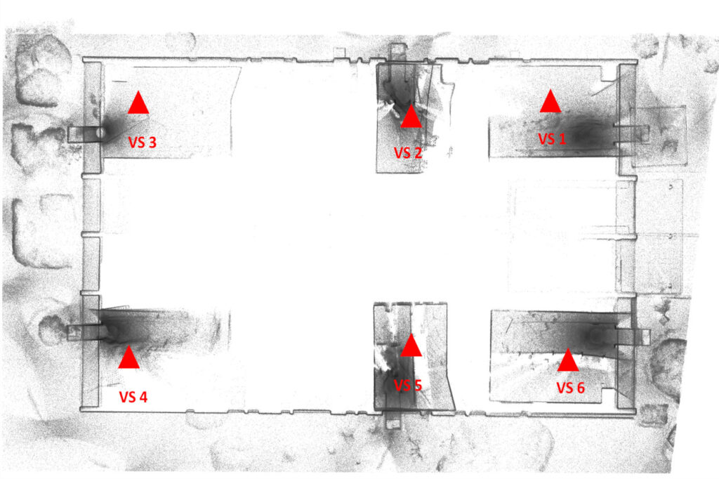
Ortho-Image of Point Cloud (horizontal section)
The ortho-image is generated from a point cloud; it is georeferenced and very precise. It allows facilitating the drawing of the BIM model or simply redrawing a plan, a section, or an elevation plan.
In this case, it allowed obtaining a 2D view of the position of crawl spaces in the building.
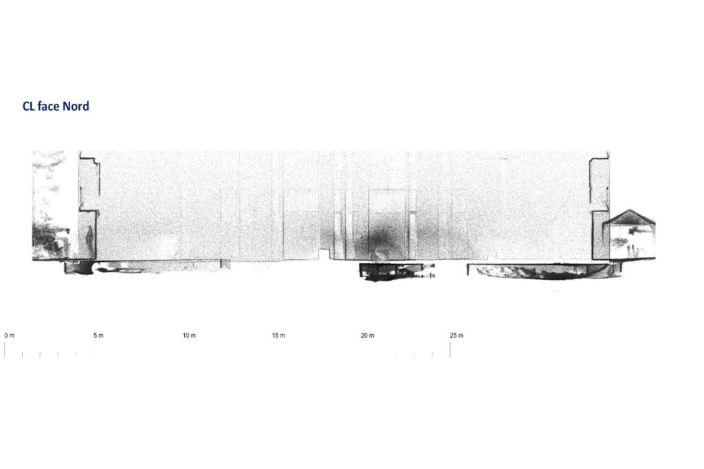
Ortho-Image of Point Cloud (vertical section)
The ortho-image of the vertical section of the point cloud allows complementing the information of the horizontal section, particularly on elevation and volumes.
The position of the sections is determined based on the project’s needs.
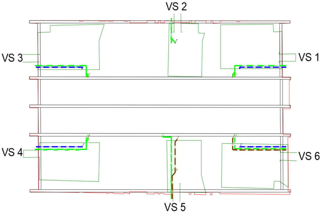
The 2D Plan with the Tracing of EP / EV Pipelines
Thanks to the data collected by our drones, the map of EP and EV networks in the crawl spaces could be drawn.
Contact Us
7 Avenue de Guitayne, 33610, Canéjan, France
contact@lynxdrone.fr
+33 6 64 29 91 64
Cookie Consent
Nous utilisons des cookies pour améliorer votre expérience sur notre site. En utilisant notre site, vous acceptez les cookies.
This website uses cookies
Websites store cookies to enhance functionality and personalise your experience. You can manage your preferences, but blocking some cookies may impact site performance and services.
Essential cookies enable basic functions and are necessary for the proper function of the website.
Name
Description
Duration
Cookie Preferences
This cookie is used to store the user's cookie consent preferences.