Drone and Robot: A Combo for a More Than Perfect Result
Drone and robot inspection of underground or confined infrastructures allows for a rapid and precise evaluation of the condition of the installations, thereby reducing downtime and maintenance costs. The collected data, such as high-resolution images and point clouds, facilitate an in-depth analysis of structural integrity and potential problems.
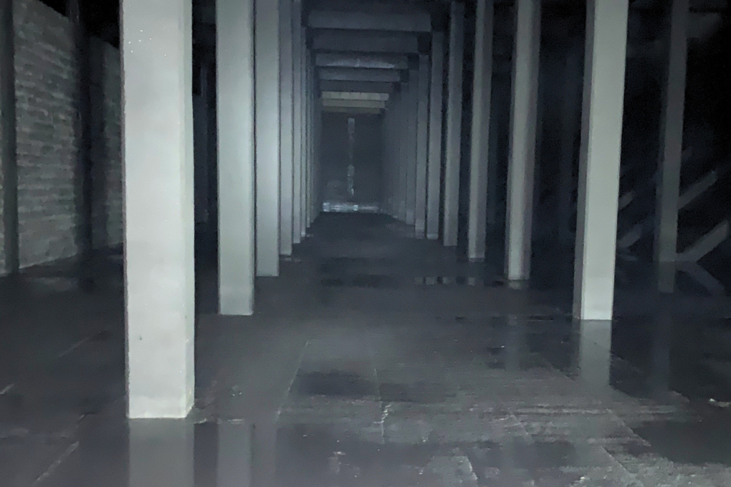
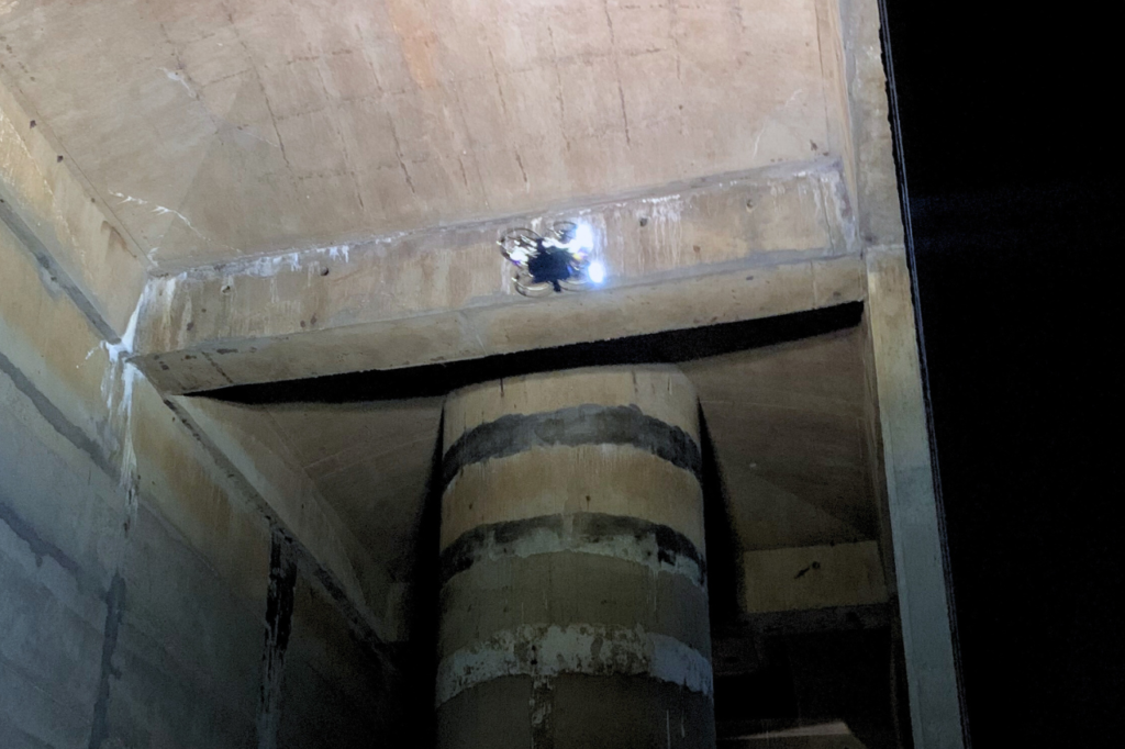
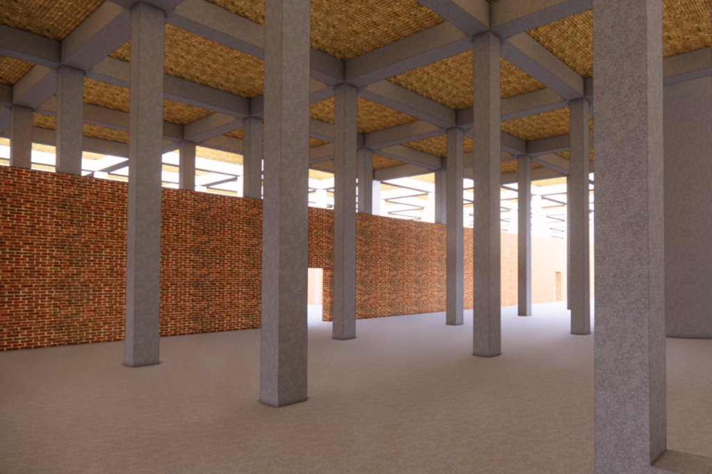
In this mission, the Lynxdrone intervention team used the drone to capture precise images as close as possible to the vault and the robot for the 3D survey because it carries a better sensor compared to that of the drone.
Context
As part of a project feasibility study, the client needed to know the condition of the vault of a 9,000 m2 water reservoir. The inspection and 3D modeling of the reservoir were carried out using Lynxdrone technologies.
On-Site Intervention
Types of Surveys
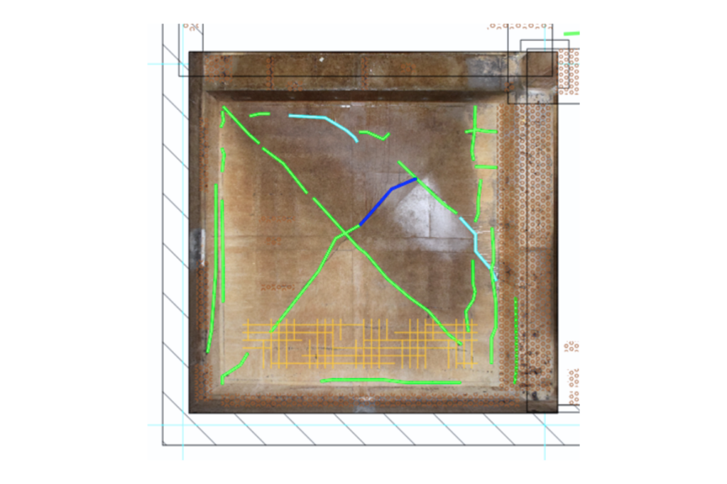
Interior 3D Survey (Scan) Vault Degradation Map (DWG) Images and Videos Virtual Site Tour
Equipment
Indoor Drone (Lynxdrone) Indoor Robot (Lynxdrone)
Detailed and High-Quality Deliverables
We accompany you with complete follow-up, ensuring that each step aligns with your expectations. Each project is unique, which is why our approach is personalized to meet your specific needs. At the end of the mission, the deliverables are presented and discussed to ensure your complete satisfaction.
Complex, Dark, and Humid Environment
Drone inspection and modeling of water reservoirs present significant challenges due to the complex, dark, and humid environment. Limited lighting conditions and wave propagation complicate image capture and communication, while humidity can affect the performance of sensors and the drone’s electronics.
Lynxdrone: Cutting-Edge Technologies
Lynxdrone’s drones and robots are perfectly adapted to this type of environment. Their embedded intelligence allows geolocalization of the drone and captured data in the absence of GNSS.
Their sensors enable precise 3D perception of the environment, assisting the operator in piloting but also in building the 3D environment. In short, high-performance technology, enhanced safety, and unmatched data quality.
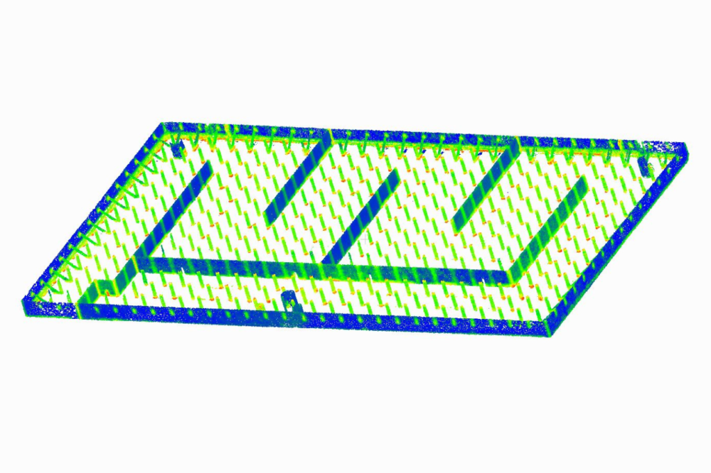
Point Cloud Generated by the Drone
The embedded algorithms on the drone enable real-time 3D modeling of the environment, which secures and facilitates the inspection mission. The resulting point cloud allows the creation of digital models and site plans. Lynxdrone’s drone is 5 times faster than conventional 3D survey methods.
Data and Deliverables Qualities
The quality of captured images and videos allows generating deliverables listing the slightest anomaly. The resolution of vault images is estimated at 5 pixels per mm, enabling identification of cracks with a width of less than 0.4mm.
Image geolocalization as well as post-processing by artificial intelligence enabled the generation of the precise vault degradation map and the reduction.
Digital Model
The digital model was generated from the point cloud and other collected information.
It is an essential tool for improving operational safety, infrastructure management, and maintenance planning.
Contact us
7 Avenue de Guitayne, 33610, Canéjan, France
contact@lynxdrone.fr
+33 6 64 29 91 64
Cookie Consent
Nous utilisons des cookies pour améliorer votre expérience sur notre site. En utilisant notre site, vous acceptez les cookies.
This website uses cookies
Websites store cookies to enhance functionality and personalise your experience. You can manage your preferences, but blocking some cookies may impact site performance and services.
Essential cookies enable basic functions and are necessary for the proper function of the website.
Name
Description
Duration
Cookie Preferences
This cookie is used to store the user's cookie consent preferences.